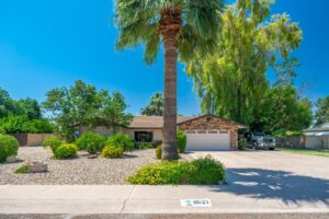
Courtesy of Arizona Premier Realty Homes & Land, LLC


Property Description
LARGE PARCEL CONSISTING OF 12.46 ACRES JUST WEST OF CONCHO, AZ. LOCATED VERY CLOSE TO PAVED COUNTY ROAD WITH EASY ACCESS TO HWY. IDEAL FOR OFF-GRID/RECREATIONAL USE & PERFECT AREA FOR YOUR WEEKEND GETAWAY FROM THE CITY, BUT STILL CLOSE ENOUGH TO TOWN. MANY ROADS IN THE AREA THAT ARE PERFECT FOR EXPLORING. APPX 5800 FT ELEVATION. ZONED ”AGRICULTURE” . LISTING FOR THE APACHE COUNTY PARENT PARCEL 212-68-503 REFERRED TO AS PARCEL A ON SURVEY*SELLER MAY CARRY*BUYER TO VERIFY, ZONING / USE , UTILITIES, ACCESS & ALL PERTINENT INFORMATION*DIRECTIONS: AZ HWY 180A/CR 5020 – WEST ON CR 5020, FOLLOW N8451 EAST, THEN SOUTH, THEN WEST. SOUTH ON N8520, WEST ON N8445, SOUTH THEN WEST ON N8521 1.25 MILES. DO NOT USE ADDRESS TO LOCATE MUST USE AERIAL MAPS & GPS COORD 34.488933, -109.696809.
Open House
Property Details and Features
-
Building
- Other structures: “None”
-
Listing
- Listing ID: 6767799
- Standard status: Active
- 120 days on market
-
Location
- Subdivision name: WOODRIDGE RANCH UNIT 12
-
Lot
- 12.46 acres
- 542,757 sqft
-
Property
- Zoning: Agriculture
-
Schools
- High school district: Sanders Unified District
-
Taxes
- Annual amount: $206
- Lot: –
-
Utilities
- “None”
Property Map
Street View
Market Trends for 85924, Concho, AZ
Nearby Schools
Request More Information
Schedule a Showing
Similar Properties Nearby
This content last updated on February 5, 2025 3:07PM. Some properties which appear for sale on this web site may subsequently have sold or may no longer be available.